UNMANNED LONG
FIXED-WING DRONE
ENDURANCE VTOL
CHCNAV · P330 Pro
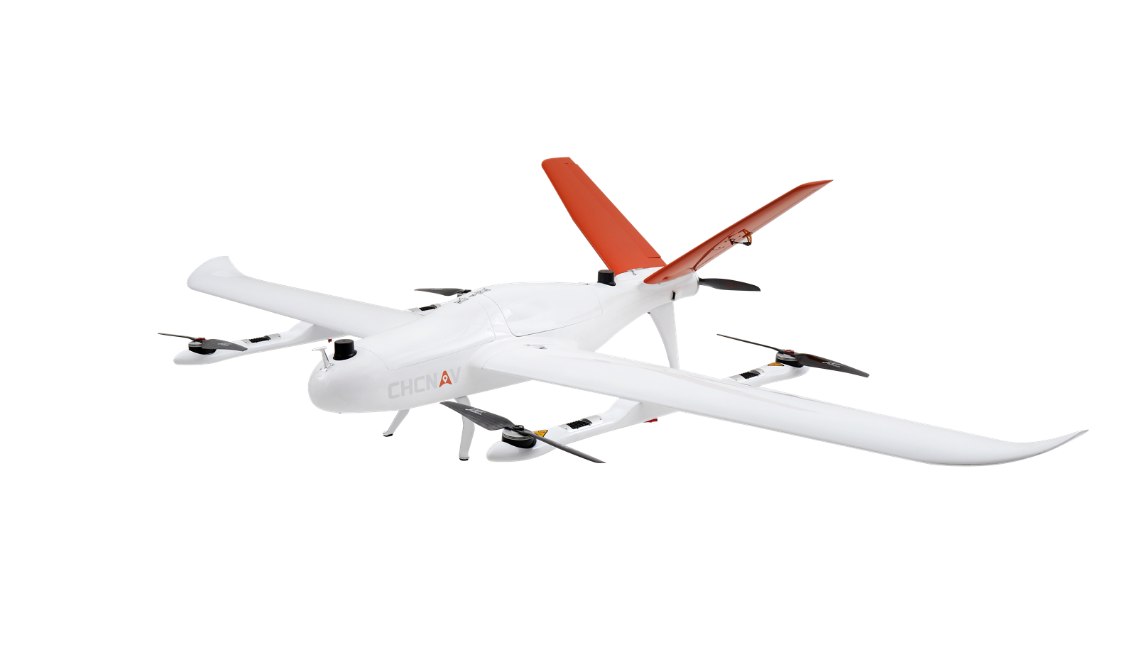
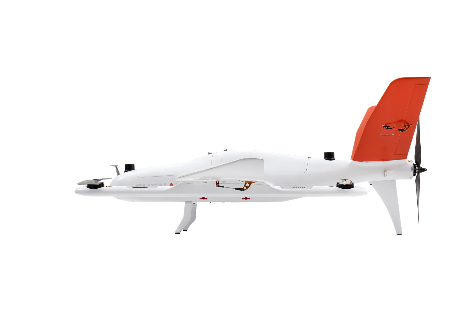
The P330 Pro is a high-performance vertical takeoff and landing (VTOL) fixed-wing unmanned aircraft system (UAS), specially designed for aerial surveying and mapping applications. With its concept of high accuracy, long endurance and multiple payloads, it meets the requirements of mapping and aerial surveying professionals for many different applications. The P330 Pro features a 100 Hz differential module, which allows aerial mapping operations at the centimeter level, and a flight endurance with payload reaching more than 150 minutes. The VTOL P330 Pro UAV allows you to conduct small- and large-scale aerial surveys with extreme data quality and at significant time and cost savings. The CHCNAV P330 Pro is an alternative to manned aircraft for surveying and mapping, mining, construction and infrastructure, environmental monitoring, agriculture, etc.
HIGH EFFICIENCY,
LONG ENDURANCE
AERIAL MAPPING.
ANYWHERE
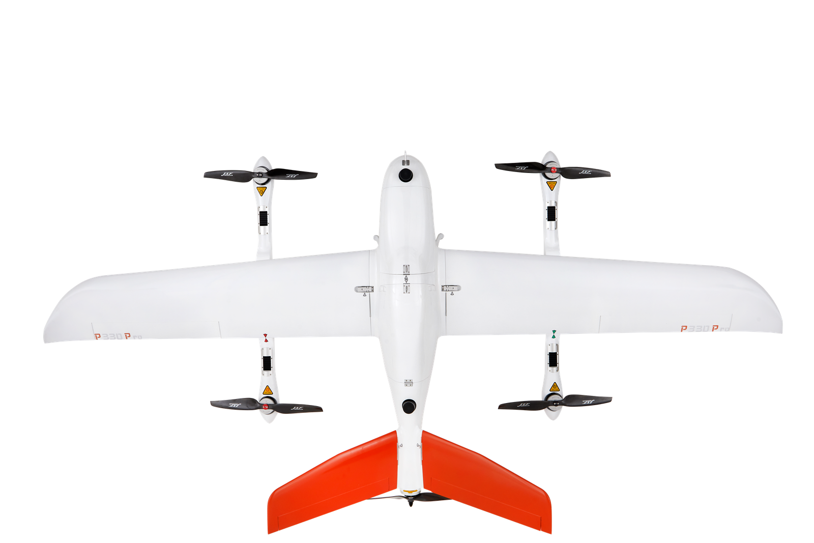
150 mins endurance and up to 20 km² coverage per flight
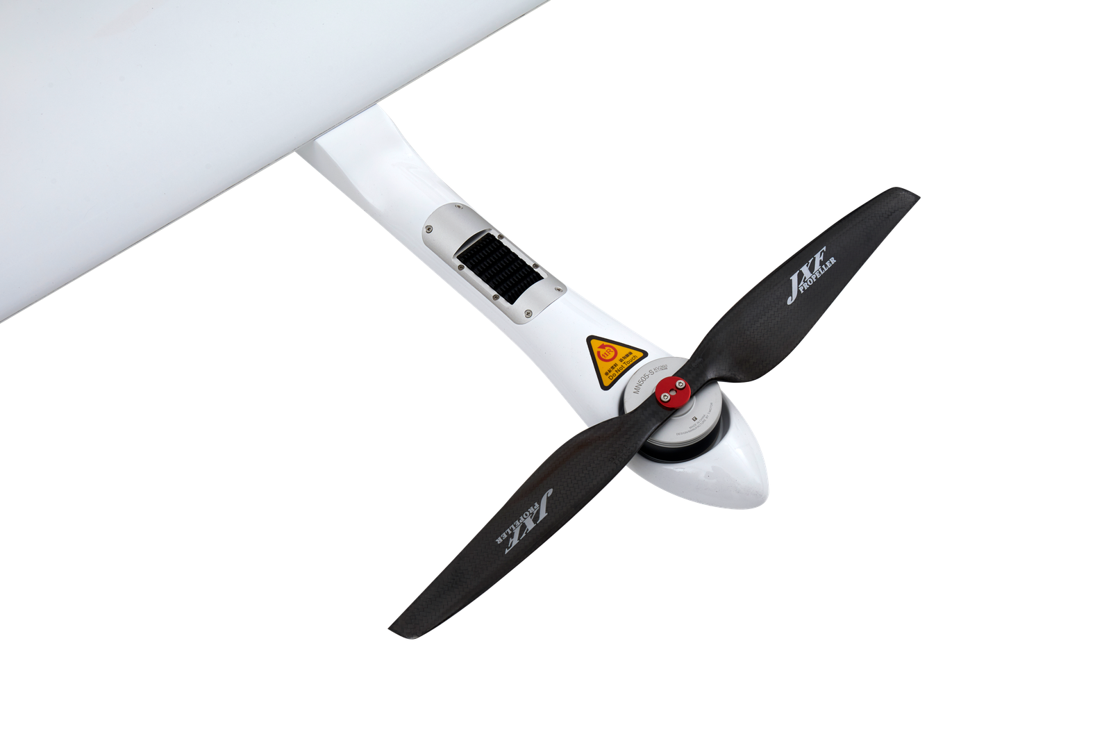
Vertical takeoff and landing with adjustable tail paddle
The P330 Pro VTOL drone is characterized by an ultra-efficient aerodynamic design and can reach 150 minutes endurance with its payload to cover large areas per flight. With a wingspan of only 2.53 m and a fuselage of only 1.21 m, its advanced power management and superior navigation algorithms, the P330 Pro can accurately map a region of 20 km² at a scale of 1:2000. Mapping highway corridors and surveying open-pit mines are now within reach in a single flight.
CAPTURE HIGHER ACCURACY DATA
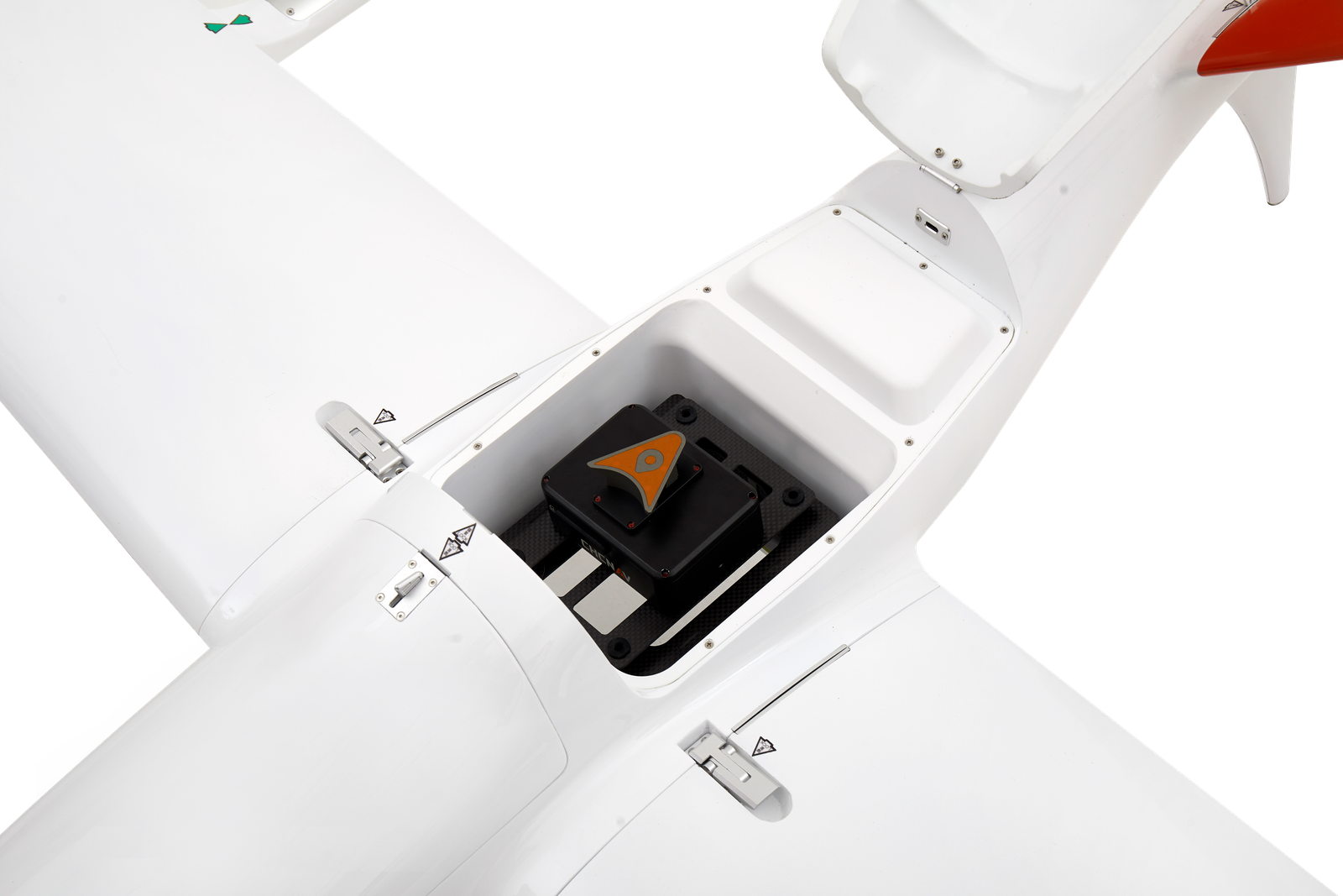
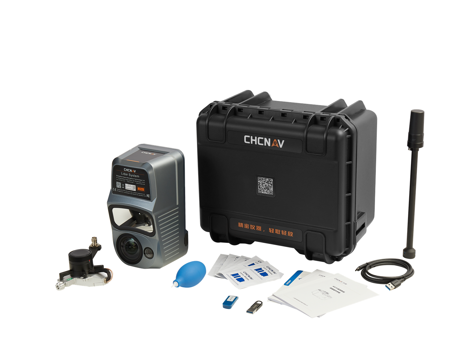
High-resolution camera and high-accuracy GNSS PPK/RTK module
SWAPPABLE AIRBORNE
SENSORS FOR ALL APPLICATIONS
Switching cameras in the field is fast and simple
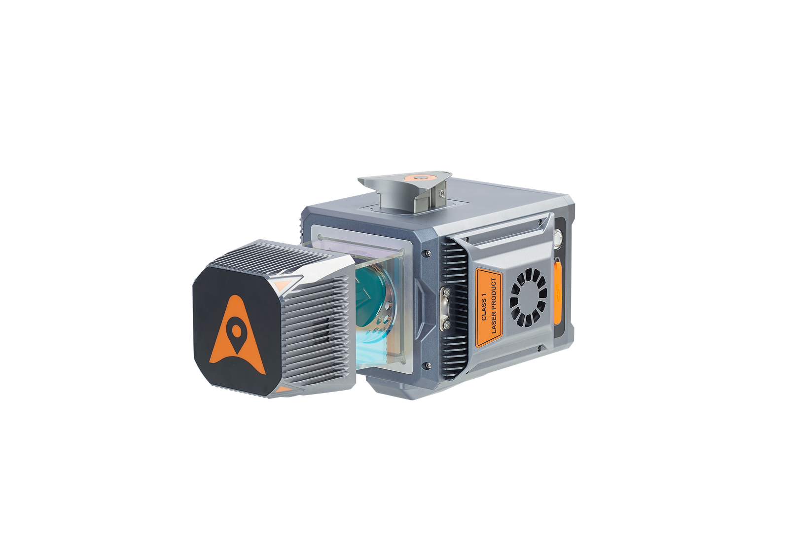
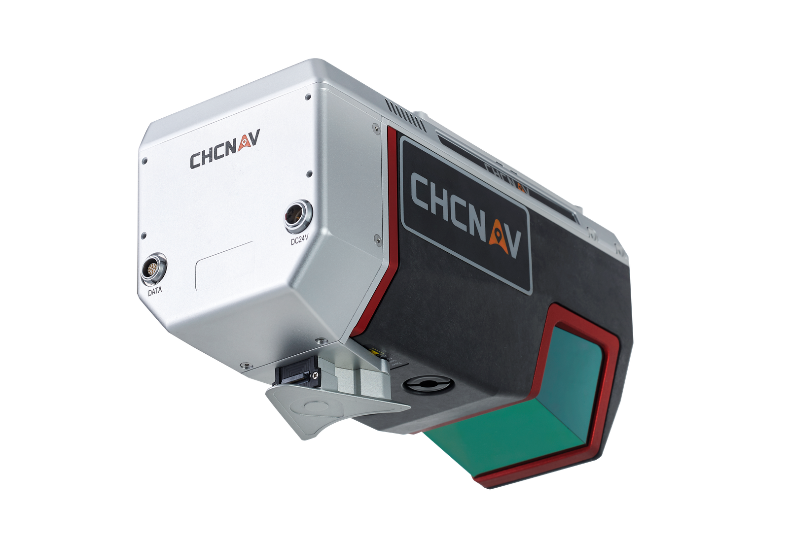
The P330 Pro is not only available with an orthophoto camera for producing orthophoto maps, but also with optional sensors, such as an oblique camera for 3D modeling applications to address the most demanding mapping and topographic surveys. The new load bay design supports a wide range of sensors, including orthophoto cameras, half-frame and full-frame oblique cameras, medium-frame cameras, multispectral cameras, or lightweight laser scanners, and the ability to quickly switch between them.
REDUCE OPERATING COSTS
AND SAVE TIME
TRUSTED BY AERIAL
SURVEY SPECIALISTS
No more systematic Ground Control Points
(GCP) required
Triple redundant flight control system and safer operation
The P330 Pro is equipped with a high-accuracy GNSS RTK/PPK module with up to 100 Hz differential data update rate. With its advanced GNSS PPK data processing and photogrammetry software, the final mapping results are accurate to the centimeter level. Avoiding the establishment of ground control points can also save up to half of the time required for the project. Faster data acquisition with a smaller field crew significantly increases the return on investment of the mission.
The P330 Pro is packed with the latest aviation technologies. A dual GNSS system, a triple IMU system, dual antenna positioning and orientation, 5 safe return to base strategies, and 9 safety monitoring checks guarantee safe flight operations and reliable aerial survey results.
The P330 Pro supports various high-resolution cameras to guarantee a high ground sampling distance (GSD) and undistorted images. Survey-grade aerial data are obtained with the built-in high-accuracy GNSS module, providing absolute horizontal accuracy of up to 1 cm/pixel.
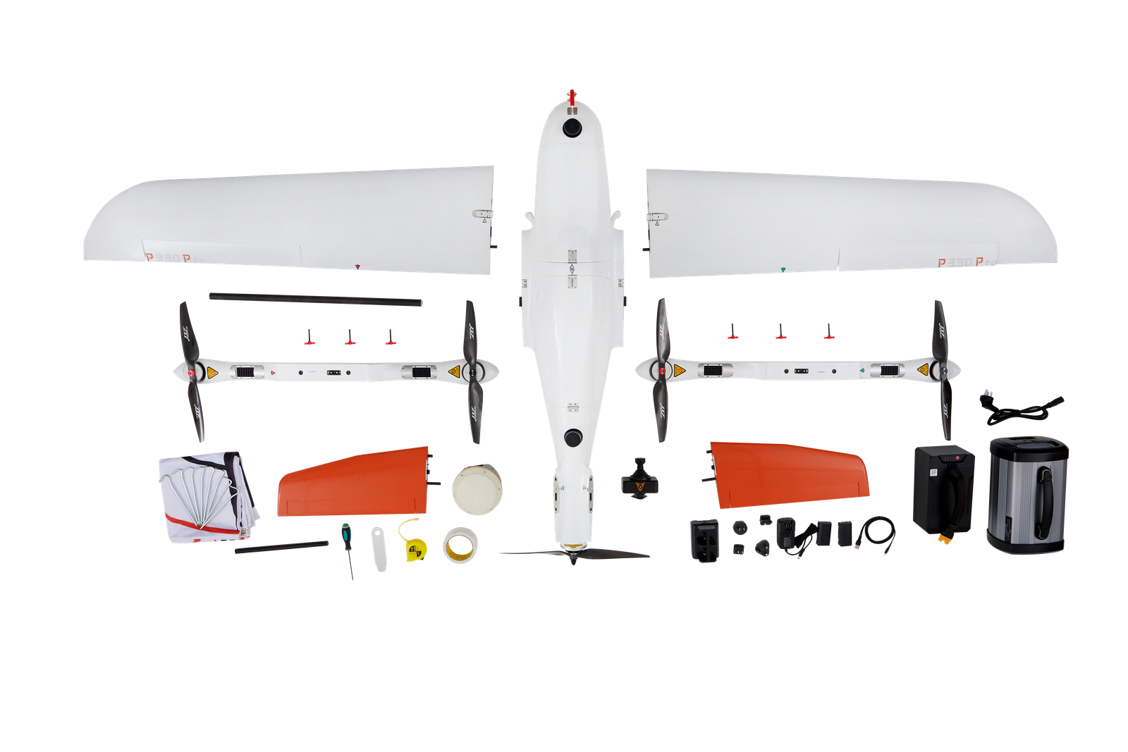
The P330 Pro is a vertical takeoff and landing fixed-wing drone. With its VTOL concept and high accuracy GNSS positioning system, it ensures take-off and landing in a smaller area. With the use of dedicated propeller blades, it can be operated at altitudes of up to 6,000 m, extending its operational range to high altitude survey areas. The P330 Pro can be assembled and disassembled in minutes and allows for easy portability to the mission site in its carrying case.