Introduction:
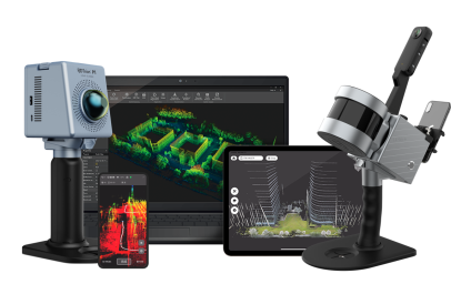
In the world of geospatial technology, a comprehensive approach to data collection and processing can make all the difference. FJDynamics has designed an integrated suite of geospatial tools that brings together their powerful Trion P1 and S1 scanners with their advanced V1T and V10i GNSS receivers. Together, these products create a streamlined, high-precision ecosystem ideal for surveying, construction, and mapping professionals.
The Power of Integration – Trion Scanners + V Series GNSS Receivers: Combining the Trion series scanners with the V series GNSS receivers offers a full-stack geospatial solution. The Trion P1 and S1 provide high-resolution scanning capabilities, capturing precise spatial data for detailed models and site maps. Meanwhile, the V1T and V10i ensure reliable, accurate positioning, adding context and precision to the scanned data.
FJD Cloud: A Seamless Data Management Platform: One of the standout features of FJDynamics’ geospatial ecosystem is its integration with the FJD Cloud. This platform allows users to upload, store, and manage data effortlessly. With real-time data access, professionals can coordinate projects remotely, track progress, and make quick adjustments. The FJD Cloud simplifies collaboration, ensuring all team members are working from the same data source.
Case Studies or Hypothetical Scenarios: Consider a large construction site requiring extensive mapping. Using the Trion P1 scanner alongside the V10i GNSS receiver allows for both high-precision 3D modeling and accurate positioning, streamlining the workflow and reducing on-site time. In remote terrain, the portability of the S1 and the robustness of the V1T make them ideal, allowing teams to capture and process data under challenging conditions.
Conclusion:
With its integrated geospatial ecosystem, FJDynamics provides professionals with a complete toolkit for efficient, accurate, and collaborative data collection. By combining the Trion scanners with the V series GNSS receivers and leveraging FJD Cloud, users can achieve new levels of productivity and precision in their geospatial projects.


